
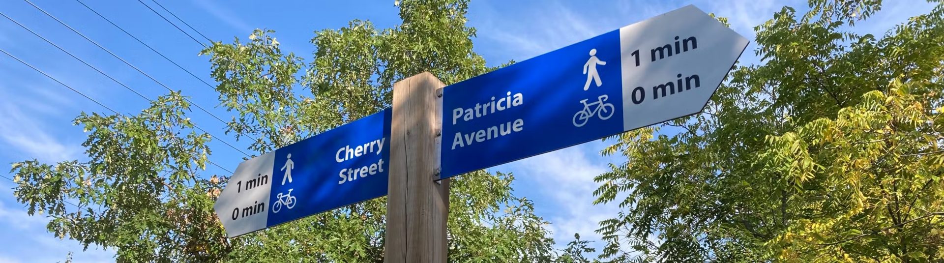
The city has identified eight major neighbourhoods and eight priority routes, each with a unique name, colour, and number for easier identification. Photo courtesy Engage Waterloo
The City of Kitchener is enhancing its active transportation network by introducing a new wayfinding strategy designed to improve navigation for residents walking, rolling, or biking across the city. As part of the Cycling and Trails Master Plan, the city has identified eight major neighbourhoods and eight priority routes, each with a unique name, colour, and number for easier identification.
Residents are encouraged to provide feedback on the proposed routes and associated signage. A survey is available online until October 25, 2024, allowing participants to review draft materials and share their thoughts. Additionally, there will be two opportunities for in-person feedback: a workshop at the Kitchener 2051 Block Party on October 5 and a “Workshop on Wheels” ride along Route 1 on October 22.
The workshops aim to engage the community in discussions about the wayfinding strategy and its connection to the city’s Official Plan. Kitchener’s Mayor Berry Vrbanovic emphasized the importance of creating safe and accessible transportation options, stating, “These routes, with unique names and wayfinding, will connect neighbourhoods, encourage the use of active transportation networks, and make routes easy to identity and navigate.” Ward 7 Councillor Bil Ioannidis encouraged residents to voice their opinions on the proposed wayfinding, saying, “We want our active transportation network to connect you to the places that matter most…Tell us what you think of our proposed wayfinding by sharing your feedback.”.
For more information on the proposed routes and signage, residents can visit EngageWR.ca/wayfinding.


