
A new DAWN for Pearson Airport
An added dimension
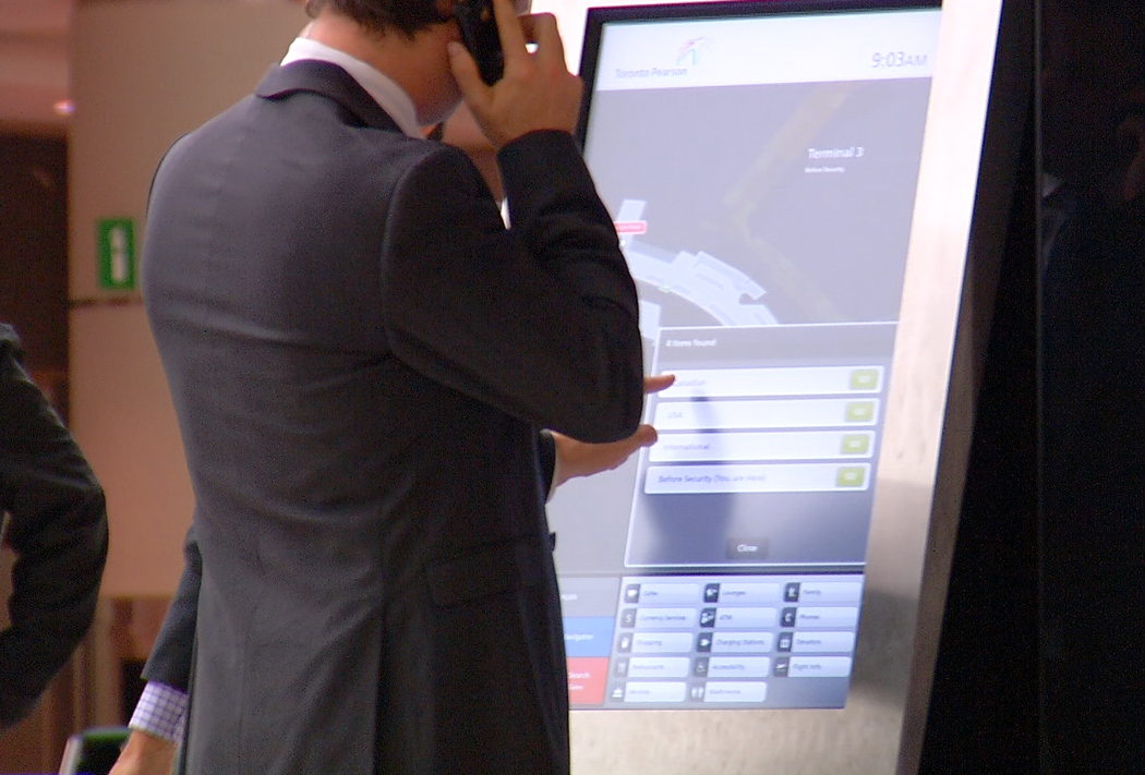
One major change that followed the pilot testing was on the part of Jibestream, which rebuilt the maps using a three-dimensional (3-D) graphics engine. This allowed for a more intuitive interface, whereby users can search through and manipulate airport wayfinding data while maintaining a perspective based on their current position.
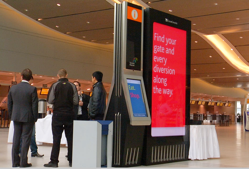
“The map gives you the correct perspective, as though you’re looking ahead from the kiosk,” says Chris Wiegand, co-founder and chief operating officer (COO) of Jibestream. “As such, the application is now oriented differently on each side of the kiosk.”
The map was also changed so as to be very ‘clean,’ with details only added as the user requests them.
“The map is the canvas,” says Wiegand. “If you push a specific ‘button’ in the legend, for example, it brings up all of the washroom locations. The idea is to prevent the map from becoming too cluttered with information at any given time.”
In contrast to this surface simplicity, Jibestream had to input a wealth of information behind the scenes, to reflect the diversity of services and amenities throughout the terminals in a useful manner.
“The system is designed to be intuitive for users, so thousands of keywords have been entered into the network’s database,” says Wiegand. “You can search by word or category. A guest might be looking to buy earphones, for example, and the map will show everywhere they are available. This approach makes it easier for the airport tenants to get noticed, as they will be displayed more frequently than if users had to search for them by name.”
The larger screen shows ads that Clear Channel has sold on the basis of time-per-day, but the touch screens can also bring up rich-media ads based on their relevance to the users’ search terms and wayfinding paths.
“If someone is looking for a gate number corresponding to a flight to Florida, for example, our system will detect that and could display an ad for an attraction in Florida,” Wiegand explains, “or promotions for stores they will pass along their way to the gate. It’s one-to-one marketing.”
The software also allows GTAA to repurpose content for other media, including web-based, print and mobile communications.
The finer details
When rolling out more units at strategic decision points throughout the terminals, GTAA made sure not to block important sightlines, both for passengers looking for their destinations and retailers who need to be easily seen.
Sign up for our newsletter
Featuring breaking news from Canada's sign and graphics industry.
Products


Read the Latest Issue
