
During the collaborative process, the client team expressed concern regarding the use of pile foundations. The frost level in Calgary’s downtown core is deep and highly variable, since many parts of it run along an old river floodplain. Underground utilities also posed complications for pile foundations, which entailed an installation risk and higher costs.
In response, the fabricator engineered three different foundation details: spread footings; mounts to existing sidewalks; and pile footings where required. Local engineers approved the use of all three options under the provincial code. Ultimately, the team used a ‘floating slab’ design for each of the sign locations.
The next step was a prototyping process, which involved both the fabricator and the city sign shop. This allowed the various stakeholders to see firsthand the size and scale of the proposed wayfinding elements, learn how the sign components would be fabricated and identify any potential risks relating to the designs. Modifications were suggested and the design intent documentation was altered accordingly.
Given the fabricator was based in the U.S., the prototype process also alerted the client team to international shipping costs and processes. The prototype was held up for a week in customs before it was cleared!
Once production moved forward in earnest, the fabricator sent photos and videos and collaborated with the team via weekly conference calls, which helped everyone manage a tight schedule and ensure quality control. And when the project was ready to ship, there was a discussion of the transfer of liability between parties.
While the fabricator was responsible for building, packing and shipping the signs, the municipal transportation department would be responsible for installation, as its staff would be able to identify any manufacturing flaws and have them repaired before installation. And afterwards, a list was compiled of minor repairs that would be needed because of damage resulting from installation alone.
The design team worked with city staff to identify and approve principles for placing the signs, including the need to locate them along key pedestrian routes at an appropriate distance from the curb, both for pedestrian safety and to reduce the impact of spray from snow and slush. Since city staff had been involved in the design process before developing the site-planning principles, the approval process was smooth and quick.
Many of the specific installation locations were modified on-site once underground utility mapping was completed and any conflicts were identified.
Launch
Installation was not viewed as the final stage of the project. Instead, it was important to build awareness of the program, so locals could make the best use of the signs.
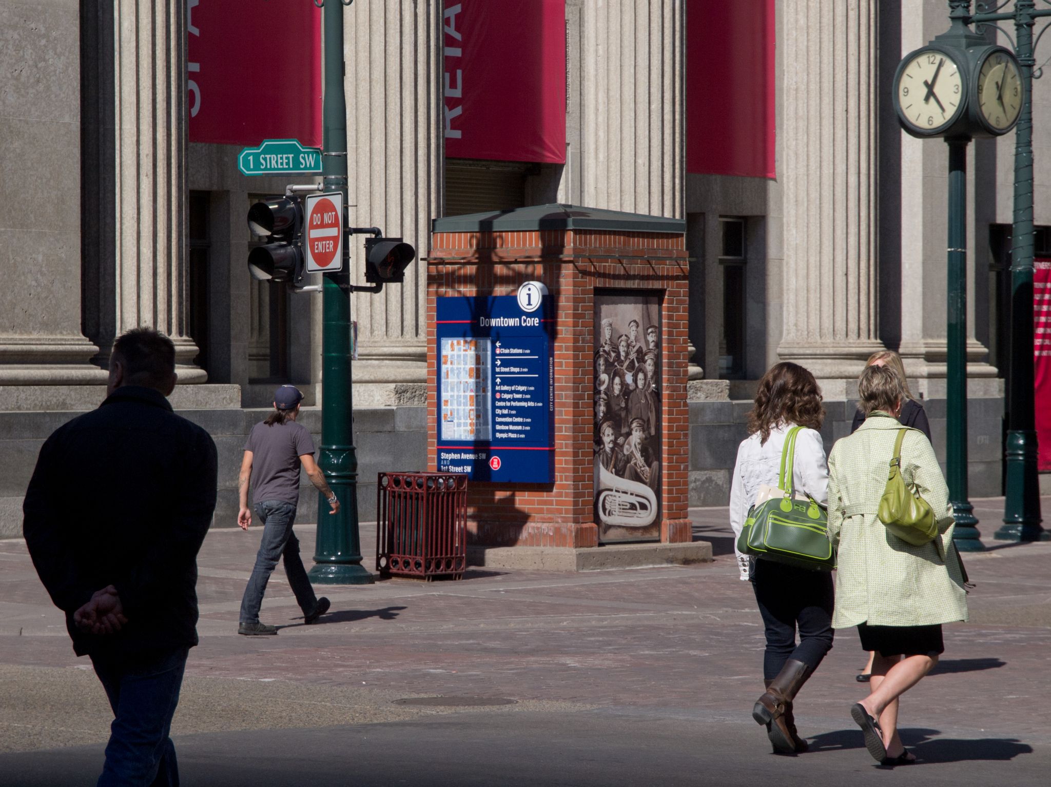
Principles were developed for sign placement, including the need to locate them away from curbs, so as to avoid the spray of snow and slush come winter.
Some of the same stakeholders who had contributed ideas during the initial planning and design phases were re-engaged, to solicit their support for the municipal government’s communication efforts. There were also events, including a media launch and celebration, to help explain the program and mark its arrival. The project’s advocates were thanked for their input and support.
Training programs were developed for front-line staff, including those at the city’s tourism bureau, as well as hotel concierges, who would be responsible for verbally sharing the logic and language of the wayfinding system to help educate visitors about how to use it.
Also, the program’s artwork was shared with other groups that need to share wayfinding information. This way, maps generated for printed, online, mobile or even other sign-based communications would be consistent, both visually and in terms of wording.
In these ways, Calgary’s municipal government has an engaged, informed and durable coalition of many stakeholders who understand the benefits of the sign system in the context of the city’s built environment, as well as its master plan for future development.
Graham Gerylo is a project planner in Calgary’s land use planning and policy department. Mark VanderKlipp is president of Corbin Design, which specializes in developing wayfinding programs. For more information, contact them via e-mail at graham.gerylo@calgary.ca and mark@corbindesign.com.
To read the full article, click here.


