
Photos courtesy ISA
By John Bosio, Craig Berger and Sapna Budev
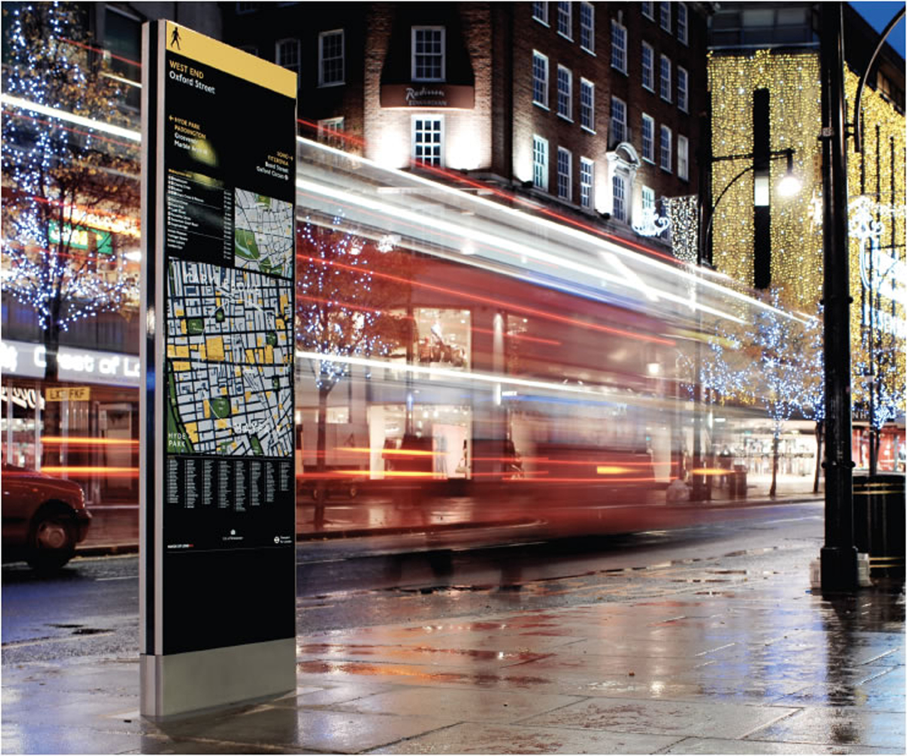
Over the last 20 years, many urban areas—from small-town main streets to the downtown districts of the world’s largest cities—have seen new wayfinding and identity systems installed to ease navigation, enhance their brand and/or reinforce key destinations. One of the reasons for a heightened interest in effective wayfinding is the desire to enhance jurisdictions’ economic sustainability. In this context, sign systems have taken on a revitalized importance.
Some of these wayfinding projects have developed to the point where they are integrated into local traffic control standards and accepted as part of ongoing financing programs. Yet, there is often little information available to signmakers, urban planners and city officials who want to develop new sign programs and learn from those cities that have already been successful. This information is crucial, given such projects may take two years from conception to installation.
The case for wayfinding signs
Visitors often navigate cities these days using smartphone apps that find destinations—and information about them—within seconds. With such tools at their disposal, they may well wonder if physical wayfinding elements are even necessary anymore.
Municipal wayfinding systems, however, serve important roles well beyond the basic needs for navigation, identification and information. Monuments, directional signs, interpretive panels, directories and even regulatory signs can all enrich the urban environment experience.
For one thing, signs define a sense of place. Urban geographer Ken Lynch suggests all cities have their own language, which residents and visitors can ‘read’ in their streets, landmarks, districts and gateways. Lynch’s research method of testing city legibility through personal cognitive maps has shown the effectiveness of successful wayfinding systems.
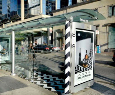
In Toronto, Kramer Design Associates (KDA) and Astral Out-of-Home have integrated a program under city oversight, where commercial advertising is used to fund street furniture and wayfinding signage. Photo courtesy Astral Out-of-Home
They can also highlight complementary destinations, bringing greater awareness to lesser-known landmarks that may not be included in apps. In Lancaster, Penn., for example, the installation of a citywide wayfinding system in 1999 led to increased name recognition for secondary destinations, including the city’s Art Museum and Central Market.
Even when drivers use Global Positioning System (GPS) devices, vehicular wayfinding signage is beneficial, as locating the destination is not the only key issue. Signs are also used to control traffic circulation patterns and consistently identify parking lots and garages. By providing clear directions to drivers at strategic locations, signs can reduce confusion and distraction and help create safer conditions.
Finally, in cases where individual organizations within the same district implement unique sign systems, particularly in terms of specialized banners, redundant neighbourhood identification and private interpretive efforts, the urban environment can appear disjointed and disorganized. A well-defined, comprehensive municipal wayfinding system will help create a consistent urban brand, a sense of organization and a perception of quality for the city and its amenities.


